Computer modeling of water flows in the Little Plover River region examined the potential effects of high-capacity wells.

A natural abundance of water, both above and below ground, is one of Wisconsin’s most defining assets. The resource has made possible much of what anchors the state's economy, from tourism and agriculture to paper milling and brewing.
Even in water-rich Wisconsin, though, the use of groundwater for municipal water systems and agricultural irrigation can lead to conflict through reducing flow to ecologically and economically important surface waters. One powerful tool for helping resolve these conflicts is a groundwater flow model. These mathematical computer models help make possible the complex task of understanding how groundwater use affect streams, rivers, lakes and wetlands.
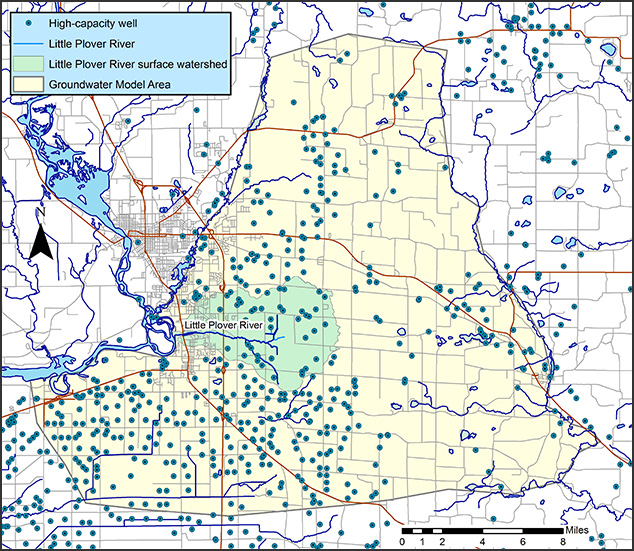
Scientists at the Wisconsin Geological and Natural History Survey use groundwater flow models to map the effects of high-capacity wells on local aquifers around the state. These models can focus on municipal wells, such as one examining the Yahara lakes in Dane County, and another focused on Portage County's Little Plover River and how it is affected by agricultural irrigation wells.
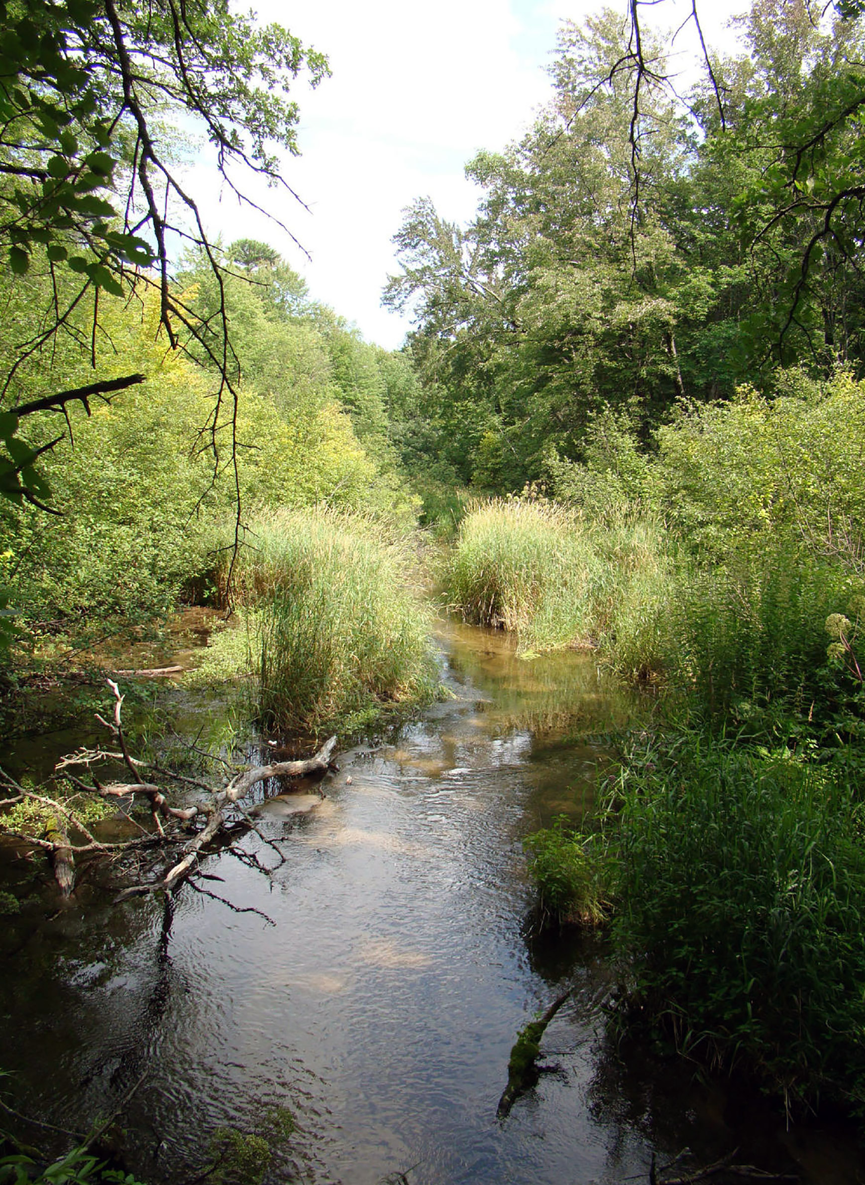
The Little Plover is an important trout fishery within a productive agricultural region. In recent years, reduced flow in the river has spotlighted the area's dependence on high-capacity irrigation wells even as stakeholders lacked a precise accounting of their impact.
Enter groundwater models, which have helped decision makers better understand the complex flow of groundwater beneath their communities, pinpoint likely culprits of reduced surface flow and troubleshoot potential solutions.
A simple way to grasp how drawing water from deep beneath the ground reduces flow at its surface is to think about groundwater a bit like a bank account, explained Wisconsin Geological and Natural History Survey director and state geologist Ken Bradbury. He described the basics of groundwater modeling in a Sept. 28, 2015, talk at the University of Wisconsin Arboretum recorded for Wisconsin Public Television's University Place.
The balance of groundwater present in a system is called its water budget. In a natural system without wells, the amount of groundwater leaving the system via springs, wetlands and lakes roughly equals the amount replenished by precipitation, much like a balanced checking account. On the other hand, aquifers that are tapped by wells that withdraw large amounts of water end up with a water deficit, meaning more water is leaving the system than is being recharged by rain and snowmelt.
In Wisconsin, the Department of Natural Resources regulates high-capacity wells, which are defined as having the capacity to withdraw more than 100,000 gallons of water per day individually or in combination with other wells on a single property. But understanding precisely how an individual high-capacity well may affect a regional groundwater system is complicated in the real world, said Bradbury, because many factors contribute to an aquifer's water budget, not simply the daily capacity of a single well. This layer of uncertainty and the sheer amount of relevant geological data that contributes to it is where the computational potency of a groundwater flow model comes in handy.
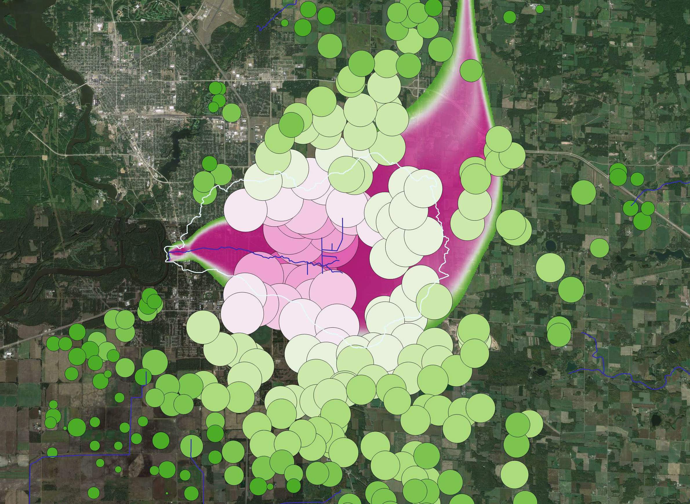
After comparing modeled maps against real-world observations, the Survey uses them to understand where and how wells are affecting a water table.
Additionally, and crucially, scientists can use models to test hypotheses about how different management systems may affect an aquifer in the future. That's what the Survey did in the region around the Little Plover River, where it worked with local stakeholders to identify wells that might be good candidates for shutting off based on their location, their importance for irrigation and the individual role they play in reducing the river's flow.
Even still, settling on a workable solution to the problem is not as straightforward as identifying it. In 2016, the Survey revealed its study of high-capacity wells in the Little Plover watershed, finding that the proximity of wells to to the river was meaningful. A year later, Bradbury and his team of researchers confirmed that wells are indeed reducing its flow. Since then, public and private sources have funded a project to the tune of $2.6 million to restore the river's flow using the Survey's groundwater flow model as a basis for the effort. Meanwhile, the DNR is using the model in a lake levels study in the region.
These applications point to the ways groundwater modeling can help policymakers to address conflict between competing interests for water use.
"So often in these water resource conflicts, I see people arguing about pros and cons, and there's a lot of misinformation or mistaken information sometimes or opinions that can't be backed up," said Bradbury. "Models are factual things … we can put in the mathematics and the mathematics don’t lie, so they give unbiased and objective solutions."